Architect, Pyrate, Relation
Barthelemy Lafon – an Engineer, Architect, Pyratical mate o’ the Laffites and relation to Capt. Swallow, would one day be known as “The Architect Of New Orleans” for designing many buildings in the Vieux Carré, the design o’ the CBD, St. Charles Ave. and the Lower Garden District (it was he who named the Muses streets). Lafon also undertook numerous public works projects, starting with repairs to the city jail (The “Calaboso”, located off Pirates Alley) damaged in a 1794 fire. Four years later, he was called as an expert to appraise the work accomplished at the Presbytère and Cabildo. Between 1797 and 1799, he improved the “bridges” or covered gutters along the city streets, and in 1802, he repaired riverfront levees. He even improved fortifications in the city, including those used in the Battle o’ New Orleans (1815). However, he was initially known as a Cartographer (aka ‘Map Maker’) and made some o’ the first accurate maps o’ Louisiana.
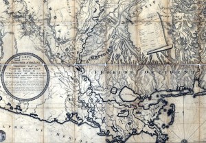
 In 1806 the US had only recently purchased the “Louisiana Territory” from France – this map was the first o’ it’s kind. Note that it is a map o’ “The Territory of Orleans, Western Florida & the Territory of Mississippi” by B. Lafon, Ingénieur Géographique (Geographic Engineer). There are also such locations as Comté d’Orleans (Orleans County) and Côte Allemand (German Coast) – now referred to as Des Allemands (simply French for “The Germans”). Des Allemands was settled in 1721 by immigrants to the colony of Louisiana from Alsace under the control of John Law (economist) and the “Company of the Indies.” Alsace, commonly referred to today as Alsace-Lorraine, is a territory right on the border of France & Germany (well known for it’s wines) and has many times been disputed as to which country owns it.

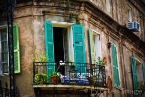
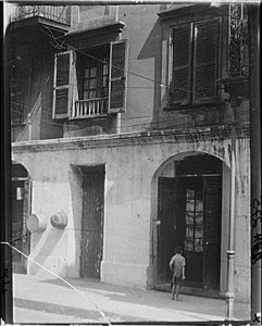
Many o’ ye will recognize this building from the corner o’ St. Peter and Royal streets – just behind St. Louis Cathedral. Designed by Lafon in 1794 (just after the ‘Great Fire’ that destroyed) for Notary Pierre Pedesclaux, it is noted as New Orleans “first skyscraper” – being the tallest building in the French Quarter (excepting the spires o’ the Cathedral). In 1805 Lafon moved his office here (though he’d rented the space out by 1807), in 1811 it was purchased by Dr. Yves Réné Lemonnier & François Grandchamps (Pharmacist) and completed (4th floor added) by Architects Latour & Laclotte. It remained in the Lemonnier family until 1860 and was used as the setting for the story “Sieur George’s House” by George Washington Cable in 1873. The ground floor was refaced in the early 1900s and again in the 1950s, the rest remains largely as it has always been. Look closely at the wrought iron in the balcony and ye will see the initials o’ the Doctor – YRM.


